RacesAlps
TDS
Demand
5 out of 5
How much it asks
Worth
4 out of 5
Whether the ticket is worth it
Courmayeur to Chamonix, France
Scorecard · is it worth it?
Worth the trip if the mountains match what you want.
The card
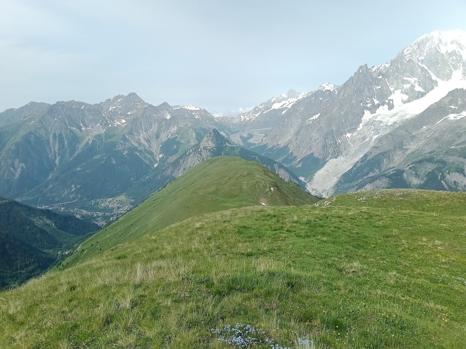
TDS is the long race in Chamonix week that people who actually like mountains talk about when the 174 is the one people photograph. Demand is 5: Sur les Traces des Ducs de Savoie, on the order of 145 kilometers and 9,100 meters of climb, a wilder and more technical line than the TMB loop, a Monday start, nights, storms, a cutoff that does not care that you are not in the flagship. It is not a 4 because denser vert on a meaner trail is the top of the demand scale even if the distance is shorter than UTMB. Technicality is a 4. Vertical is a 5. That pairing is the card.
Worth is 4, destination, not icon. The mountains are a 5. The weekend is a 4 because you still pay in stones and Chamonix prices, and because the icon in this valley is the 174, which means TDS will always be the other long race. That is not a softness. That is honesty about prestige versus terrain. If you wanted the photograph under the church, look at UTMB. If you wanted the harder line, this is the one. Organization confidence is high.
The next date is not yet posted by the RD. CCC is the worth-5 100K. OCC is the short day. UTMB is the icon 5/5, Pyramides and all. TDS is 5/4 because demand can exceed the weekend's icon status. Promoters cannot buy our number. They can put all four races on one website. We scored them as four products. If you can only pick one flight to this valley, decide whether you wanted fame, scenery-per-kilometer, or the mean line. They are not the same ticket.
Who it is for
Mountain ultra runners who want the harder Chamonix-week long race and already know UTMB's TMB loop is the famous one, not the meanest one.
Who should skip
Anyone who wanted the icon 174 for the photograph, or a first alpine 100. TDS is not the gentle introduction to this valley.
Elevation
Tap or hover for miles, clock, and aidft
Dark from 20:25 to 06:42 local. The median finisher is in the dark from Checrouit - Maison Vieille onward (1:08am+1d).
Bottom ticks are aid. Longest gap 12.6 mi.
Finisher pace · 2026
Median finishers (~50th percentile of 715 finishers). Not a predicted you. · retrieved 2026-09-06 (repo record)
Checrouit - Maison Vieille 4.8 mi
- Aid–aid
- 1.3 h
- Elapsed
- 1.3 h
- Clock
- 1:08 am +1d
Lac Combal 10.3 mi
- Aid–aid
- 1.6 h
- Elapsed
- 2.9 h
- Clock
- 2:44 am +1d
0.8 h slack
La Thuile - Petit St Bernard 22.9 mi
- Aid–aid
- 3.9 h
- Elapsed
- 6.8 h
- Clock
- 6:38 am +1d
1.9 h slack
Seez 29.7 mi
- Aid–aid
- 1.5 h
- Elapsed
- 8.3 h
- Clock
- 8:08 am +1d
Bourg St Maurice 31.7 mi
- Aid–aid
- 0.4 h
- Elapsed
- 8.7 h
- Clock
- 8:32 am +1d
2.5 h slack
Fort de la Platte 34.8 mi
- Aid–aid
- 2.4 h
- Elapsed
- 11.1 h
- Clock
- 10:56 am +1d
2.8 h slack
Cormet de Roselend 41.1 mi
- Aid–aid
- 2.7 h
- Elapsed
- 13.8 h
- Clock
- 1:38 pm +1d
3.6 h slack
La Gittaz 45.8 mi
- Aid–aid
- 1.9 h
- Elapsed
- 15.7 h
- Clock
- 3:32 pm +1d
4.0 h slack
Beaufort 57.4 mi
- Aid–aid
- 4.8 h
- Elapsed
- 20.5 h
- Clock
- 8:20 pm +1d
6.7 h slack
Hauteluce 61.3 mi
- Aid–aid
- 2.5 h
- Elapsed
- 23.0 h
- Clock
- 10:50 pm +1d
6.7 h slack
Le Signal 71.8 mi
- Aid–aid
- 5.6 h
- Elapsed
- 28.6 h
- Clock
- 4:26 am +2d
6.8 h slack
Les Contamines 76.6 mi
- Aid–aid
- 1.5 h
- Elapsed
- 30.1 h
- Clock
- 5:56 am +2d
7.3 h slack
Bellevue 85.1 mi
- Aid–aid
- 5.0 h
- Elapsed
- 35.1 h
- Clock
- 10:56 am +2d
7.3 h slack
Les Houches 88 mi
- Aid–aid
- 1.0 h
- Elapsed
- 36.1 h
- Clock
- 11:56 am +2d
7.3 h slack
Chamonix 93.7 mi
- Aid–aid
- 1.4 h
- Elapsed
- 37.5 h
- Clock
- 1:20 pm +2d
7.4 h slack
Local clock derived from published start + finisher splits, not a forecast.
Finishers only (DNFs missing, so the real back of the field is slower).
Where the cutoff bites
Least margin: Lac Combal, 28 min for the back of the field.
Finishers only. DNFs are missing, so the real back of the field is slower.
Hardest stretch
Hardest stretch: Bourg St Maurice to Fort de la Platte, 3,991 ft in 3.1 mi.
Segment gains from the course elev profile.
| From | To | Mi | Gain | Loss |
|---|---|---|---|---|
| Start | Checrouit - Maison Vieille | 4.87.7 km | 2,630 ft802 m | 152 ft46 m |
| Checrouit - Maison Vieille | Lac Combal | 5.58.9 km | 1,605 ft489 m | 1,486 ft453 m |
| Lac Combal | La Thuile - Petit St Bernard | 12.620.3 km | 3,299 ft1,006 m | 2,824 ft861 m |
| La Thuile - Petit St Bernard | Seez | 6.810.9 km | 0 ft0 m | 4,361 ft1,329 m |
| Seez | Bourg St Maurice | 2.03.2 km | 366 ft112 m | 77 ft23 m |
| Bourg St Maurice | Fort de la Platte | 3.15 km | 3,991 ft1,216 m | 0 ft0 m |
| Fort de la Platte | Cormet de Roselend | 6.310.1 km | 1,866 ft569 m | 2,293 ft699 m |
| Cormet de Roselend | La Gittaz | 4.77.6 km | 1,846 ft563 m | 2,136 ft651 m |
| La Gittaz | Beaufort | 11.618.7 km | 2,031 ft619 m | 5,937 ft1,810 m |
| Beaufort | Hauteluce | 3.96.3 km | 1,560 ft475 m | 278 ft85 m |
| Hauteluce | Le Signal | 10.516.9 km | 3,934 ft1,199 m | 2,370 ft722 m |
| Le Signal | Les Contamines | 4.87.7 km | 1,219 ft372 m | 1,445 ft440 m |
| Les Contamines | Bellevue | 8.513.7 km | 3,696 ft1,127 m | 4,455 ft1,358 m |
| Bellevue | Les Houches | 2.94.7 km | 585 ft178 m | 1,192 ft363 m |
| Les Houches | Chamonix | 5.79.2 km | 226 ft69 m | 463 ft141 m |
- Start
- 4,011 ft1,223 m
- Finish
- 3,396 ft1,035 m
- Net
- −615 ft−187 m
- Longest climb
- 5,043 ft1,537 m
Point to point. Net downhill. Total climb is still in Facts.
Weekend
Official handbook facts
TDS 2026 race page / UTMB mandatory equipment · retrieved 2026-09-06 (repo record)
Field
Last editions · 100M scored distance
Field evidence: who showed up, who finished, how long. DNF is that evidence, not a difficulty score. Public results, scored distance only.
DNF over the years
DNF 45% in 2026, 38% the year before.
2026
- Starters
- 1,290
- Finishers
- 715
- DNF
- 45%
- Win
- 19:28:43
- Median
- 37:30:47
2025
- Starters
- 1,935
- Finishers
- 1,207
- DNF
- 38%
- Win
- 18:22:17
- Median
- 36:28:24
2024
- Starters
- 1,874
- Finishers
- 1,111
- DNF
- 41%
- Win
- 18:59:36
- Median
- 37:29:43
Starters, finishers, and win from public results tables for the scored race. Median from LiveTrail finish times.
Overall field only. Not a pro or sponsored subset.
Where people drop
DNF by last recorded station · 2026. 1,290 starters.
- Checrouit1
- Mt Favre1
- Lac Combal34
- Chavannes6
- La Thuile25
- Séez11
- BSM55
- BSM22
- F. Platte36
- Passeur1
- Roselend103
- La Gittaz56
- Entre2Nants6
- Outray14
- Beaufort e129
- Beaufort s12
- Hauteluce22
- B Girotte6
- Signal S12
- Contamines17
- Col Tricot3
- Bellevue1
- Houches2
Most drops: Beaufort e, 129 of 1,290 in 2026
LiveTrail 2026 stats abandonments (abds)retrieved 2026-09-07
Climate
Typical August at the start area · historical race-week weather
- Typical high
- 75°F (24°C)
- Typical low
- 52°F (11°C)
- Typical precip
- 3.3 in (83 mm) / August
- Days with rain
- 35% of days
- High point
- 8,366 ft (2,550 m)
BewareRain on race weekend in 2 of the last 3 years.
2015–2024 August means at the start / massif. · Open-Meteo ERA5 / climate · retrieved 2026-09-06 (repo record)
Dimensions
Ten 1–5 scores with a one-line why. Organization has a separate confidence tag.
Supporting dimensions · organization confidence high
About 145 km, harder line than the TMB loop. A long alpine push, not a 100K.
On the order of 9,100 m. Denser and meaner than UTMB's 10,000 m over more distance.
Wilder than the TMB: steeper, more technical, less of a hiking-highway. Technicality 4.
Late August, start earlier in the week. Storms, night, heat. Same massif, less crowd on course.
Alpine cols, not Colorado 14ers. Repeated, not once.
Stones, Index, first-come registration, then a Monday start while the town is already a circus.
The connoisseur long race of UTMB week. Deep, not the global-final spotlight.
Same machine as UTMB. Competent, commercial.
Circuit tax for the harder line. Worth 4: the mountains, minus the icon identity.
The massif off the TMB highway. Scenery 5, with fewer selfie poles on the col.
| Dimension | Score | Why |
|---|---|---|
Distance & format How much does the advertised distance and format actually ask? | 5 out of 5 | About 145 km, harder line than the TMB loop. A long alpine push, not a 100K. |
Vertical How serious is the climbing, not just the mile marker? | 5 out of 5 | On the order of 9,100 m. Denser and meaner than UTMB's 10,000 m over more distance. |
Technicality Hands, poles, route-finding, or just a long dirt road? | 4 out of 5 | Wilder than the TMB: steeper, more technical, less of a hiking-highway. Technicality 4. |
Climate Heat, monsoon, ice, or a friendly summer afternoon? | 4 out of 5 | Late August, start earlier in the week. Storms, night, heat. Same massif, less crowd on course. |
Altitude Does the air change the race, or is it a talking point? | 3 out of 5 | Alpine cols, not Colorado 14ers. Repeated, not once. |
Logistics How hard is the weekend around the race: travel, crew, lodging, rules? | 5 out of 5 | Stones, Index, first-come registration, then a Monday start while the town is already a circus. |
Prestige & field Does the start list and history change what the weekend feels like? | 4 out of 5 | The connoisseur long race of UTMB week. Deep, not the global-final spotlight. |
Organization From public evidence, does the event look competently run? | 4 out of 5 | Same machine as UTMB. Competent, commercial. |
Value Entry fee, travel tax, and lottery friction versus what you get on course. | 3 out of 5 | Circuit tax for the harder line. Worth 4: the mountains, minus the icon identity. |
Adventure & scenery Would you fly for the place even if nobody kept score? | 5 out of 5 | The massif off the TMB highway. Scenery 5, with fewer selfie poles on the col. |