RacesNew Zealand
Tarawera Ultra
Demand
3 out of 5
How much it asks
Worth
4 out of 5
Whether the ticket is worth it
Rotorua, North Island, New Zealand
Scorecard · is it worth it?
Worth the trip if the mountains match what you want.
The card
We score the Tarawera TMiler, the 100-mile product, not the 50K. Demand is 3: a hundred miles of lake and forest trail around Rotorua, largely runnable, summer in February, a real night, not a mountain 100. Vertical is a 2. Technicality is a 2. Altitude is a 1. Those numbers are honesty, not a sneer. A hundred miles is still a hundred miles. Heat can still come out. Roots can still add up. This is not HURT and it is not Hardrock and it is not the Southern Alps.
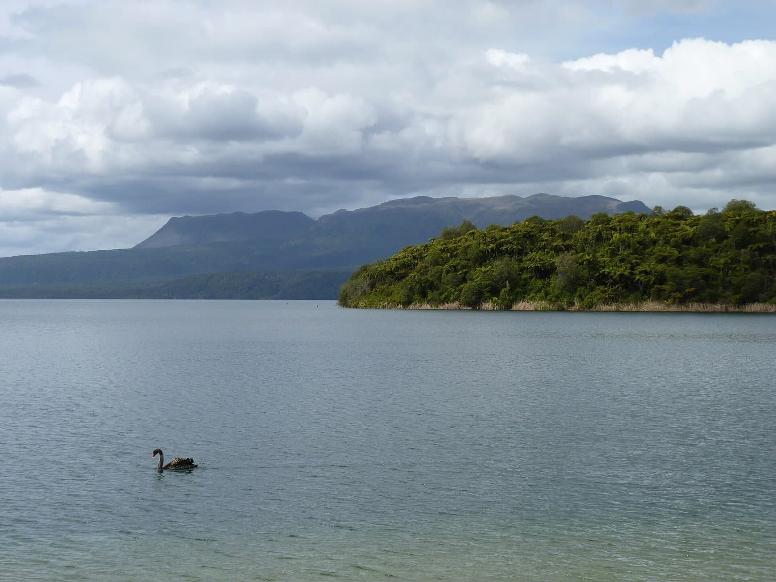
Worth is 4, destination. People fly a long-haul for this weekend, which is why it is not regional. They fly for New Zealand in February, lakes, redwoods, a well-run event, a first or fast 100 in a place that photographs like a holiday. That is allowed. It is also why worth is not 5. If your flight is for mountains, you bought the wrong island angle. If your flight is for a 100 miles of beautiful runnable trail at the other end of the world, the weekend can work. Organization confidence is high. taraweraultra.co.nz is complete. The next edition is February 13, 2027. Black Canyon is the other February fast 100K in this catalog, desert, Golden Ticket. Tarawera is the lake 100. Neither is a skip. Neither is a ridge. We listed them because Americans and Europeans actually spend ultra weekends this way, and because lying about terrain to protect a mountain brand would be the other kind of catalog. Destination 3/4. Go if you wanted this. Do not go because you thought Rotorua was Aoraki.
Who it is for
Runners who want a 100 miles of New Zealand lake and forest trail in February, and who already know this is not a Southern Alps mountain 100.
Who should skip
Anyone who thought Tarawera meant alpine, or anyone who will not spend a long-haul on a runnable 100. If you wanted NZ mountains, look harder than Rotorua.
Elevation
Tap or hover for miles, clock, and aidft
Bottom ticks are aid. Longest gap 9.7 mi.
Finisher pace · 2026
Median finishers (~50th percentile of 307 finishers). Not a predicted you. · retrieved 2026-09-06 (repo record)
Puarenga 6.6 mi
- Aid–aid
- 1.4 h
- Elapsed
- 1.4 h
- Clock
- 5:24 am
Rotokakahi (Green Lake) 13.4 mi
- Aid–aid
- 1.5 h
- Elapsed
- 2.9 h
- Clock
- 6:54 am
Buried Village 18.6 mi
- Aid–aid
- 1.1 h
- Elapsed
- 4.0 h
- Clock
- 8:00 am
2.8 h slack
Rerewhakaaitu 34.8 mi
- Aid–aid
- 3.9 h
- Elapsed
- 7.9 h
- Clock
- 11:54 am
4.6 h slack
Okahu 41.1 mi
- Aid–aid
- 1.7 h
- Elapsed
- 9.6 h
- Clock
- 1:36 pm
5.2 h slack
Outlet 55.2 mi
- Aid–aid
- 3.8 h
- Elapsed
- 13.4 h
- Clock
- 5:24 pm
6.3 h slack
Otamuri 63.8 mi
- Aid–aid
- 2.6 h
- Elapsed
- 16.0 h
- Clock
- 8:00 pm
6.8 h slack
Okataina 73.7 mi
- Aid–aid
- 4.4 h
- Elapsed
- 20.4 h
- Clock
- 12:24 am +1d
5.9 h slack
Millar 83.2 mi
- Aid–aid
- 3.8 h
- Elapsed
- 24.2 h
- Clock
- 4:12 am +1d
6.1 h slack
Tikitapu (Blue Lake) 90.7 mi
- Aid–aid
- 3.8 h
- Elapsed
- 28.0 h
- Clock
- 8:00 am +1d
4.3 h slack
Redwoods 96.7 mi
- Aid–aid
- 2.5 h
- Elapsed
- 30.5 h
- Clock
- 10:30 am +1d
4.0 h slack
Village Green 101.3 mi
- Aid–aid
- 1.0 h
- Elapsed
- 31.5 h
- Clock
- 11:30 am +1d
4.6 h slack
Local clock derived from published start + finisher splits, not a forecast.
Finishers only (DNFs missing, so the real back of the field is slower).
Where the cutoff bites
Least margin: Redwoods, 72 min for the back of the field.
Finishers only. DNFs are missing, so the real back of the field is slower.
Hardest stretch
Hardest stretch: Okataina to Millar, 1,343 ft in 9.5 mi.
Segment gains from the course elev profile.
| From | To | Mi | Gain | Loss |
|---|---|---|---|---|
| Start | Puarenga | 6.610.6 km | 670 ft204 m | 580 ft177 m |
| Puarenga | Rotokakahi (Green Lake) | 6.810.9 km | 764 ft233 m | 367 ft112 m |
| Rotokakahi (Green Lake) | Buried Village | 5.28.4 km | 393 ft120 m | 634 ft193 m |
| Buried Village | Te Ariki Isthmus | 9.715.6 km | 1,103 ft336 m | 1,136 ft346 m |
| Te Ariki Isthmus | Rerewhakaaitu | 6.510.5 km | 567 ft173 m | 172 ft52 m |
| Rerewhakaaitu | Okahu | 6.310.1 km | 314 ft96 m | 428 ft130 m |
| Okahu | Hawea | 6.610.6 km | 989 ft301 m | 1,147 ft350 m |
| Hawea | Outlet | 7.512.1 km | 423 ft129 m | 741 ft226 m |
| Outlet | Otamuri | 8.613.8 km | 1,099 ft335 m | 604 ft184 m |
| Otamuri | Rotoiti | 6.710.8 km | 1,062 ft324 m | 736 ft224 m |
| Rotoiti | Okataina | 3.25.1 km | 202 ft62 m | 533 ft162 m |
| Okataina | Millar | 9.515.3 km | 1,343 ft409 m | 1,599 ft487 m |
| Millar | Tikitapu (Blue Lake) | 7.512.1 km | 849 ft259 m | 519 ft158 m |
| Tikitapu (Blue Lake) | Redwoods | 6.09.7 km | 378 ft115 m | 991 ft302 m |
| Redwoods | Village Green | 4.67.4 km | 81 ft25 m | 133 ft41 m |
- Start
- 1,018 ft310 m
- Finish
- 936 ft285 m
- Net
- −82 ft−25 m
- Longest climb
- 1,753 ft534 m
Start and finish are within 400 ft. Treat net as a loop.
Weekend
Official handbook facts
Tarawera Ultra Trail T-Miler race page · retrieved 2026-09-06 (repo record)
Field
Last editions · 100M scored distance
Field evidence: who showed up, who finished, how long. DNF is that evidence, not a difficulty score. Public results, scored distance only.
DNF over the years
DNF 40% in 2026, 18% the year before.
2026
- Starters
- 508
- Finishers
- 307
- DNF
- 40%
- Win
- 16:26:17
- Median
- 31:32:47
2025
- Starters
- 415
- Finishers
- 340
- DNF
- 18%
- Win
- 15:16:54
- Median
- 28:48:24
2024
- Starters
- 450
- Finishers
- 330
- DNF
- 27%
- Win
- 15:00:57
- Median
- 29:40:11
LiveTrail race stats for starters/finishers/DNF. Median from finish classement times.
Overall field only. Not a pro or sponsored subset.
Where people drop
DNF by last recorded station · 2026. 508 starters.
- Te Puia1
- Puarenga1
- Lake Rotok2
- Buried Vil18
- Okahu35
- Outlet44
- Otamuri63
- Okataina15
- Millar16
- Tikitapu5
Most drops: Otamuri, 63 of 508 in 2026
LiveTrail 2026 stats abandonments (abds)retrieved 2026-09-07
Climate
Typical February at the start area · historical race-week weather
- Typical high
- 73°F (23°C)
- Typical low
- 58°F (15°C)
- Typical precip
- 4.6 in (117 mm) / February
- Days with rain
- 37% of days
- High point
- 2,493 ft (760 m)
BewareRain on race weekend in 2 of the last 3 years.
2015–2024 February means at the start / massif. · Open-Meteo ERA5 / climate · retrieved 2026-09-06 (repo record)
Dimensions
Ten 1–5 scores with a one-line why. Organization has a separate confidence tag.
Supporting dimensions · organization confidence high
We score the TMiler, the 100-mile product, not the 50K or 100K undercards.
Rolling volcanic lake country. The vert is not a mountain 100.
Forest and lake trail, largely runnable. Technical enough for roots, not a scramble.
Mid-February in Rotorua: summer, heat possible, not an alpine freeze.
North Island lake country. The air is not the race.
A long-haul for most of the people who read this site. Easy once you are in Rotorua.
A deep Oceania field, UTMB-world adjacent. Not an icon 100.
Mature event, publicly documented. Competent summer classic.
A long-haul for a runnable 100. Worth 4 is the place, not the terrain tax.
Lakes, redwoods, volcanic North Island. Beautiful. Not the Southern Alps.
| Dimension | Score | Why |
|---|---|---|
Distance & format How much does the advertised distance and format actually ask? | 4 out of 5 | We score the TMiler, the 100-mile product, not the 50K or 100K undercards. |
Vertical How serious is the climbing, not just the mile marker? | 2 out of 5 | Rolling volcanic lake country. The vert is not a mountain 100. |
Technicality Hands, poles, route-finding, or just a long dirt road? | 2 out of 5 | Forest and lake trail, largely runnable. Technical enough for roots, not a scramble. |
Climate Heat, monsoon, ice, or a friendly summer afternoon? | 3 out of 5 | Mid-February in Rotorua: summer, heat possible, not an alpine freeze. |
Altitude Does the air change the race, or is it a talking point? | 1 out of 5 | North Island lake country. The air is not the race. |
Logistics How hard is the weekend around the race: travel, crew, lodging, rules? | 4 out of 5 | A long-haul for most of the people who read this site. Easy once you are in Rotorua. |
Prestige & field Does the start list and history change what the weekend feels like? | 3 out of 5 | A deep Oceania field, UTMB-world adjacent. Not an icon 100. |
Organization From public evidence, does the event look competently run? | 4 out of 5 | Mature event, publicly documented. Competent summer classic. |
Value Entry fee, travel tax, and lottery friction versus what you get on course. | 3 out of 5 | A long-haul for a runnable 100. Worth 4 is the place, not the terrain tax. |
Adventure & scenery Would you fly for the place even if nobody kept score? | 4 out of 5 | Lakes, redwoods, volcanic North Island. Beautiful. Not the Southern Alps. |