RacesMid-Atlantic
Massanutten Mountain Trails 100
Demand
4 out of 5
How much it asks
Worth
3 out of 5
Whether the ticket is worth it
Fort Valley, Virginia, United States
Scorecard · is it worth it?
Strong weekend if you already live nearby.
The card
Massanutten is the East Coast 100 that is actually hard, and it is still regional. That is not a contradiction. Demand is 4 because over 18,500 feet of short, rugged climbs on a rocky Massanutten Mountain course with a 36-hour cutoff is a mountain-trail 100. Technicality is a 5. The club's own line is 'Massanutten Rocks,' which is a pun and also a warning. Altitude is a 1. Heat in May can show up. None of that makes it a default transcontinental flight. A 4/3 is the honest pairing: the day is harder than Vermont, and the weekend is still a drive, not a pilgrimage.
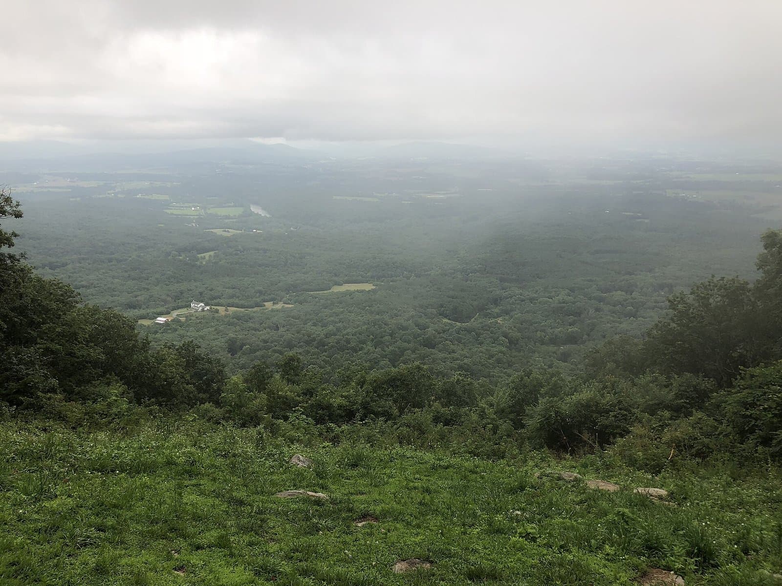
Worth is 3, regional. If you live in the Mid-Atlantic, this is the rocky 100. If you are in California choosing one 100 to fly for, this is not it. The Shenandoah is handsome. The logistics are a drive to Caroline Furnace Lutheran Camp in Fort Valley. Regional means worth it if you are nearby, not a default plane ticket. VHTRC has been telling East Coast runners the truth about these rocks for years; we are not going to pretend that truth is a reason to book from Denver. Organization confidence is medium: VHTRC publishes like a club that expects volunteers and training runs, which is the right kind of public record. The next edition is May 15, 2027. Vermont is the historic rollers 100 in this region. Hellgate is the night 100K in December. MMT is the rocks. None of them are HURT. None of them are Hardrock. If you wanted a destination technical 100 from this batch, Superior and HURT are the flights. If you already own a tent in Virginia, this is the one.
Who it is for
East Coast mountain-trail runners who want a rocky 100 with a 36-hour cutoff and a club that has been telling the truth about the rocks for years.
Who should skip
Anyone flying across the country for Virginia ridge. If you need a plane, HURT or Superior are the technical 100s we would discuss first.
Elevation
Tap or hover for miles, clock, and aidft
Dark from 20:19 to 06:01 local. The median finisher is in the dark from Edinburg Gap onward (7:42am).
Bottom ticks are aid. Longest gap 9.9 mi.
Finisher pace · 2026
Median finishers (~50th percentile of 103 finishers). Not a predicted you. · retrieved 2026-09-03
Edinburg Gap 12.1 mi
- Aid–aid
- 2.7 h
- Elapsed
- 2.7 h
- Clock
- 7:42 am
1.1 h slack
Woodstock Tower 20.3 mi
- Aid–aid
- 2.1 h
- Elapsed
- 4.8 h
- Clock
- 9:48 am
1.7 h slack
Powells Fort 25.8 mi
- Aid–aid
- 1.3 h
- Elapsed
- 6.1 h
- Clock
- 11:06 am
2.2 h slack
Elizabeth Furnace 33.3 mi
- Aid–aid
- 2.1 h
- Elapsed
- 8.2 h
- Clock
- 1:12 pm
2.5 h slack
Shawl Gap Parking 38 mi
- Aid–aid
- 1.5 h
- Elapsed
- 9.7 h
- Clock
- 2:42 pm
2.7 h slack
Veach Gap Parking 41.1 mi
- Aid–aid
- 0.8 h
- Elapsed
- 10.5 h
- Clock
- 3:30 pm
2.9 h slack
Indian Grave Trailhead 50.1 mi
- Aid–aid
- 2.9 h
- Elapsed
- 13.4 h
- Clock
- 6:24 pm
3.0 h slack
Habron Gap Parking 54 mi
- Aid–aid
- 0.9 h
- Elapsed
- 14.3 h
- Clock
- 7:18 pm
3.2 h slack
Camp Roosevelt 63.9 mi
- Aid–aid
- 3.5 h
- Elapsed
- 17.8 h
- Clock
- 10:48 pm
4.0 h slack
Gap Creek 69.6 mi
- Aid–aid
- 2.1 h
- Elapsed
- 19.9 h
- Clock
- 12:54 am +1d
4.5 h slack
Visitor Center 78.1 mi
- Aid–aid
- 3.4 h
- Elapsed
- 23.3 h
- Clock
- 4:18 am +1d
4.9 h slack
Bird Knob 81.6 mi
- Aid–aid
- 1.6 h
- Elapsed
- 24.9 h
- Clock
- 5:54 am +1d
Picnic Area 87.9 mi
- Aid–aid
- 2.0 h
- Elapsed
- 26.9 h
- Clock
- 7:54 am +1d
4.9 h slack
Gap Creek II 96.8 mi
- Aid–aid
- 3.3 h
- Elapsed
- 30.2 h
- Clock
- 11:12 am +1d
4.7 h slack
Caroline Furnace Camp 100.6 mi
- Aid–aid
- 1.2 h
- Elapsed
- 31.4 h
- Clock
- 12:24 pm +1d
4.6 h slack
Local clock derived from published start + finisher splits, not a forecast.
Finishers only (DNFs missing, so the real back of the field is slower).
Where the cutoff bites
Least margin: Edinburg Gap, 50 min for the back of the field.
Finishers only. DNFs are missing, so the real back of the field is slower.
Hardest stretch
Hardest stretch: Camp Roosevelt to Gap Creek, 1,796 ft in 5.7 mi.
Segment gains from the course elev profile.
| From | To | Mi | Gain | Loss |
|---|---|---|---|---|
| Start | Moreland Gap | 4.16.6 km | 785 ft239 m | 28 ft9 m |
| Moreland Gap | Edinburg Gap | 8.012.9 km | 1,057 ft322 m | 1,160 ft354 m |
| Edinburg Gap | Woodstock Tower | 8.213.2 km | 892 ft272 m | 844 ft257 m |
| Woodstock Tower | Powells Fort | 5.58.9 km | 162 ft49 m | 763 ft233 m |
| Powells Fort | Elizabeth Furnace | 7.512.1 km | 861 ft262 m | 1,265 ft386 m |
| Elizabeth Furnace | Shawl Gap Parking | 4.77.6 km | 781 ft238 m | 935 ft285 m |
| Shawl Gap Parking | Veach Gap Parking | 3.15 km | 587 ft179 m | 180 ft55 m |
| Veach Gap Parking | Indian Grave Trailhead | 9.014.5 km | 1,150 ft351 m | 1,598 ft487 m |
| Indian Grave Trailhead | Habron Gap Parking | 3.96.3 km | 495 ft151 m | 69 ft21 m |
| Habron Gap Parking | Camp Roosevelt | 9.915.9 km | 1,523 ft464 m | 1,147 ft350 m |
| Camp Roosevelt | Gap Creek | 5.79.2 km | 1,796 ft547 m | 807 ft246 m |
| Gap Creek | Visitor Center | 8.513.7 km | 1,234 ft376 m | 893 ft272 m |
| Visitor Center | Bird Knob | 3.55.6 km | 573 ft175 m | 909 ft277 m |
| Bird Knob | Picnic Area | 6.310.1 km | 474 ft144 m | 1,649 ft503 m |
| Picnic Area | Gap Creek II | 8.914.3 km | 1,249 ft381 m | 1,292 ft394 m |
| Gap Creek II | Caroline Furnace Camp | 3.86.1 km | 0 ft0 m | 79 ft24 m |
- Start
- 1,131 ft345 m
- Finish
- 1,132 ft345 m
- Net
- +1 ft0 m
- Longest climb
- 1,614 ft492 m
Start and finish are within 400 ft. Treat net as a loop.
Weekend
Official handbook facts
- Start
- 05:00
- Crew
- 12.1, 33.3, 38, 54, 63.9, 69.6, 78.1, 87.9, 96.8 mi
- Pacer from
- 63.5 mi
MMT 100 pacer and crew pages · retrieved 2026-09-06 (repo record)
Field
Last editions · 100M scored distance
Field evidence: who showed up, who finished, how long. DNF is that evidence, not a difficulty score. Public results, scored distance only.
DNF over the years
DNF 43% in 2026, 40% the year before.
2026
- Starters
- 182
- Finishers
- 103
- DNF
- 43%
- Win
- 18:26:17
- Median
- 31:21:56
2025
- Starters
- 157
- Finishers
- 94
- DNF
- 40%
- Win
- 20:11:23
- Median
- 32:10:50
2024
- Starters
- 176
- Finishers
- 119
- DNF
- 32%
- Win
- 20:59:05
- Median
- 30:48:29
Latest median 31:21:56 (2026) vs the 36-hour cutoff already listed in Gate. Not a hardness score.
Overall field only. Not a pro or sponsored subset.
Climate
Typical May at the start area · historical race-week weather
- Typical high
- 74°F (23°C)
- Typical low
- 53°F (12°C)
- Typical precip
- 3.9 in (98 mm) / May
- Days with rain
- 47% of days
- High point
- 2,953 ft (900 m)
BewareRain on race weekend in 3 of the last 3 years.
2015–2024 May means at the start / massif. · Open-Meteo ERA5 / climate · retrieved 2026-09-06 (repo record)
Dimensions
Ten 1–5 scores with a one-line why. Organization has a separate confidence tag.
Supporting dimensions · organization confidence medium
A 100 with a 36-hour cutoff because the rocks are the race.
Over 18,500 ft of short, rugged climbs. Dense, not a 14er.
Massanutten Rocks is the slogan and the truth. Technicality 5.
May in the Shenandoah: heat possible, not a tropical loop.
Virginia ridge, not altitude. Feet fail before lungs.
Fort Valley is a drive from the Mid-Atlantic. Regional on purpose.
VHTRC classic. Respected by people who like rocks. Not a global destination start list.
Club race with unusually complete public logistics. Medium-high from the public record.
A savage 100 if you already live nearby. Not a default plane ticket.
Massanutten and the Shenandoah Valley. Handsome. Not a flight-for-the-view 100.
| Dimension | Score | Why |
|---|---|---|
Distance & format How much does the advertised distance and format actually ask? | 4 out of 5 | A 100 with a 36-hour cutoff because the rocks are the race. |
Vertical How serious is the climbing, not just the mile marker? | 4 out of 5 | Over 18,500 ft of short, rugged climbs. Dense, not a 14er. |
Technicality Hands, poles, route-finding, or just a long dirt road? | 5 out of 5 | Massanutten Rocks is the slogan and the truth. Technicality 5. |
Climate Heat, monsoon, ice, or a friendly summer afternoon? | 3 out of 5 | May in the Shenandoah: heat possible, not a tropical loop. |
Altitude Does the air change the race, or is it a talking point? | 1 out of 5 | Virginia ridge, not altitude. Feet fail before lungs. |
Logistics How hard is the weekend around the race: travel, crew, lodging, rules? | 2 out of 5 | Fort Valley is a drive from the Mid-Atlantic. Regional on purpose. |
Prestige & field Does the start list and history change what the weekend feels like? | 3 out of 5 | VHTRC classic. Respected by people who like rocks. Not a global destination start list. |
Organization From public evidence, does the event look competently run? | 4 out of 5 | Club race with unusually complete public logistics. Medium-high from the public record. |
Value Entry fee, travel tax, and lottery friction versus what you get on course. | 3 out of 5 | A savage 100 if you already live nearby. Not a default plane ticket. |
Adventure & scenery Would you fly for the place even if nobody kept score? | 3 out of 5 | Massanutten and the Shenandoah Valley. Handsome. Not a flight-for-the-view 100. |